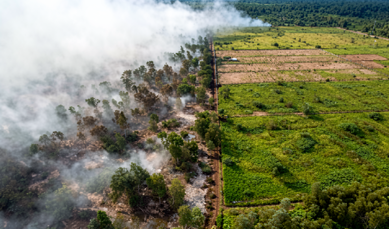
BNPB: Forest Fires Hit 5 Mountain Areas in East Java
BNPB - East Java's highland tourism season has been thrown into disarray after land and forest blazes simultaneously engulfed five separate mountain zones
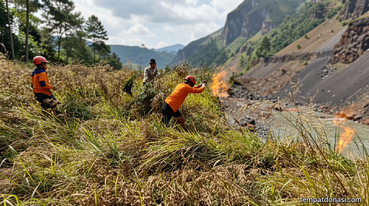
Five East Java Peaks Under Fire as Authorities Halt All Mountain Climbing
Tempatdonasi.com – BNPB – East Java’s highland tourism season has been thrown into disarray after land and forest blazes simultaneously engulfed five separate mountain zones across the province. The National Disaster Management Agency (BNPB) confirmed on Friday that climbing operations have been suspended across all affected peaks, a precaution aimed at protecting visitors from smoke, unstable ground, and active fire lines still burning on steep slopes.
The closures come at a particularly sensitive time for local economies that depend heavily on trekking, crater-visit tourism, and weekend hiking packages. East Java’s volcanic and forested highlands draw hundreds of thousands of domestic and international visitors each year, and the simultaneous shutdown of multiple trails represents one of the broadest single-season suspensions in recent memory.
Where the Fires Are Burning
Berton SP Panjaitan, acting head of the BNPB Disaster Data, Information, and Communication Center, briefed reporters in Jakarta on Friday with a list of five active hotspot zones detected during afternoon monitoring:
Mount Semeru, straddling Lumajang and Malang regencies; Mount Wilis, spanning Nganjuk and Kediri; Mount Ungup-Ungup, rising between Banyuwangi and Bondowoso; Mount Arjuno Welirang in Pasuruan; and Bukit Sariwani in Probolinggo. Each site presents distinct terrain challenges, from near-vertical volcanic flanks to dense lowland forest canopy, complicating ground access for suppression crews.
Mount Semeru: The Largest Firefront
The most extensive blaze since the trail closure that took effect on August 26, 2026, has consumed roughly 1,888.91 hectares of vegetation and bare ground. The scorched zone stretches through Ranukembang and Ranupane Village, runs along the Post 1 hiking corridor, and extends westward toward Ranu Kumbolo, one of the most popular alpine lakes on the Semeru massif.
Aerial suppression using the East Java Provincial Government’s PK-DAP helicopter was temporarily grounded after crews encountered electrical-system malfunctions and repeated failures of the water-bucket delivery mechanism. With aerial support unavailable, ground teams have been forced to rely on hand tools, firebreak construction, and manual water application across terrain that is often too steep for mechanized equipment.
Ungup-Ungup Spreads Toward Bondowoso; Ijen Crater Closed
A separate fire on Mount Ungup-Ungup in Banyuwangi has crossed the administrative boundary into Bondowoso, consuming approximately 20 hectares of forest. In response, authorities announced the temporary closure of the Ijen Crater Nature Reserve effective Friday, September 4. The crater, famous for its acidic turquoise lake and sulfur emissions, sits at the base of the Ungup-Ungup ridge, making smoke drift and ember transport a direct hazard to visitors and staff.
This decision follows the earlier shutdown of the Semeru hiking trail, which Bromo Tengger Semeru National Park (TNBTS) management enacted on August 26, 2026, when initial hotspots first appeared on the lower slopes.
Wilis, Arjuno Welirang, and Sariwani: Containment Struggles
On Mount Wilis, fires have blackened an estimated 16 hectares of mixed vegetation across the Nganjuk and Kediri sections. Crews report that the dense undergrowth and limited road access slow containment considerably.
At Mount Arjuno Welirang in Pasuruan and on Bukit Sariwani in Probolinggo, the primary challenge is not the flame front itself but the persistent smoke plumes rising from slopes too steep for safe crew deployment. Visibility for nearby communities and for any remaining trail users remains impaired.
Multi-Agency Response on the Ground
Berton confirmed that a joint operational team is working around the clock at every accessible hotspot. The coalition includes the Regional Disaster Management Agency (BPBD), TNBTS rangers, Grand Forest Park (Tahura) personnel, state forestry enterprise Perhutani, Indonesian National Armed Forces (TNI) units, Indonesian National Police (Polri) support teams, Manggala Agni — the national forest-firefighting corps — and local volunteer groups. Coordination among these bodies is essential given that the fires cross multiple administrative and jurisdictional boundaries within a single afternoon’s burn period.
“A joint team from the Regional Disaster Management Agency (BPBD), Bromo Tengger Semeru National Park (TNBTS), Grand Forest Park (Tahura), state forestry firm Perhutani, the Indonesian National Armed Forces (TNI), the Indonesian National Police (Polri), Manggala Agni, and volunteers continues to conduct ground operations against accessible hotspots,” Berton said.
Public Advisories and the Cost of Delayed Reporting
BNPB has issued a direct appeal to residents, hikers, and tourism operators: respect every posted closure without exception, and observe the standing prohibition on open burning of agricultural waste, forest debris, or any combustible material within mountain zones. In Java’s dry season, a small unattended fire can reach a major firefront within hours, particularly on slopes where wind accelerates ember cast.
“The public is also requested to immediately report any fires or smoke plumes in forest zones to local authorities so they can be addressed promptly,” Berton said.
Early reporting remains the single most effective tool available to communities. The fires now burning across five peaks began, in most cases, as small ground fires that went unreported until they had grown beyond the reach of initial suppression resources. Local regency disaster desks, forest-park ranger stations, and village heads all maintain hotlines that can dispatch Manggala Agni or BPBD teams within minutes — a window that closes quickly once a fire has climbed into canopy or crossed a ridge line.
Until all hotspots are confirmed extinguished and terrain is declared stable, climbing, crater visits, and guided trekking across the affected peaks will remain suspended. Authorities have not yet announced a reopening timeline, noting that post-fire slope stability assessments and residual-heat checks must be completed before trails are cleared for public use.
Related Reading
Frequently Asked Questions
What is BNPB?
BNPB is the main topic of this guide. The article explains the context, practical details, and next steps readers should understand.
Why does BNPB matter?
BNPB matters because readers are looking for a useful answer, not just a short summary. Good content should match search intent and help them decide what to do next.