Geological Agency: Anak Krakatau Eruption Returns to Strombolian Phase
The restless volcano rising from the waters of the Sunda Strait has shed its most turbulent recent behavior. Mount Anak Krakatau, the youngest member of the
Anak Krakatau’s Volcanic Rhythm Settles Back Into Its Familiar Pattern
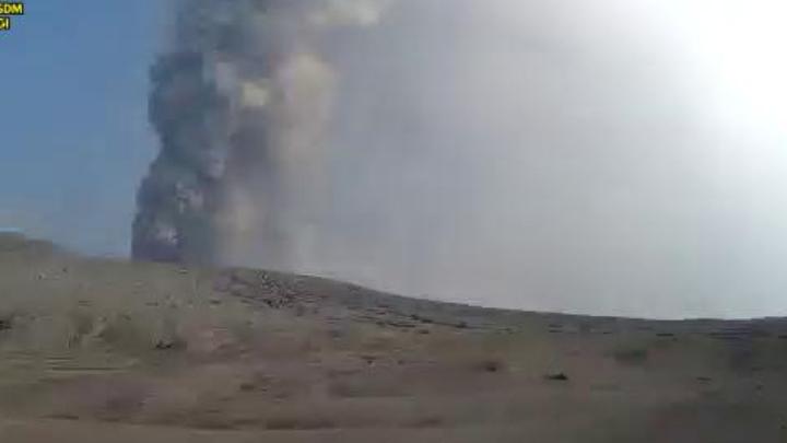
Tempatdonasi.com – The restless volcano rising from the waters of the Sunda Strait has shed its most turbulent recent behavior. Mount Anak Krakatau, the youngest member of the Krakatau volcanic family, has slipped back into what scientists call the Strombolian eruptive regime — a mode characterized by brief, moderate bursts of lava and gas rather than prolonged, high-amplitude explosions. The shift marks a meaningful easing of conditions for communities, shipping lanes, and air corridors that ring the strait between Java and Sumatra.
What the Seismographs Showed
Monitoring instruments stationed at the volcano’s observation post logged a steady decline in seismic tremor beginning on September 5. By September 8, the latest data indicated that only eight minor eruptive events had been captured, each confined to a window of roughly ten to fifteen seconds. Volcanic ejecta and ash fallout were observed settling predominantly along the flanks of the cone and within the crater rim itself, rather than being lofted into the upper atmosphere over long distances.
Lana Saria, who heads the Geological Agency under Indonesia’s Ministry of Energy and Mineral Resources (ESDM), characterized the current behavior as a return to the mountain’s baseline eruptive personality. Speaking in Bandung on Tuesday, she described the pattern plainly:
“It has now returned to the typical Strombolian phase of Mount Anak Krakatau. Eruptions occur with a moderate amplitude, are not too long, and last only a few seconds.”
In practical terms, a Strombolian cycle means the volcano is venting gas and small volumes of molten rock in discrete pulses separated by quiet intervals. It is not an explosive, ash-blanketing event, nor is it a quiet effusive flow. For residents and workers within the vicinity, the distinction matters because it shapes evacuation planning, air-quality advisories, and maritime safety protocols.
Why the December 2018 Tsunami Remains the Benchmark
Public memory in the region is still shaped by the catastrophic flank collapse of December 22, 2018, when a sector of Anak Krakatau’s cone slid into the strait and generated a tsunami that swept coastal settlements on both Java and Sumatra, killing more than four hundred people. That event was driven by sustained magmatic inflation and structural weakening of the cone’s outer slopes — conditions quite unlike what the current deformation record shows.
Saria was explicit on this point, noting that the latest geodetic analyses reveal no measurable lateral displacement of the crater walls that would signal a repeat of the 2018 failure mechanism.
“Meanwhile, deformation data analysis currently shows no shifting of the crater walls that could potentially trigger a landslide into the water.”
The distinction is critical for the thousands of vessels that transit the Sunda Strait daily, one of the world’s busiest shipping corridors linking the Indian Ocean to the Pacific. A flank collapse of Anak Krakatau’s scale would generate a tsunami with little warning time for nearby ports and fishing communities.
Air Corridors and Coastal Livelihoods Reopen
The earlier dispersal of ash columns had forced temporary restrictions at several airports along the western Java and southern Sumatra coastlines. Once the plume thinned and wind patterns carried residual particulate away from flight paths, authorities cleared the airspace and commercial schedules resumed. Saria confirmed that the improvement in atmospheric clarity following the reduced ash output had a direct, positive effect on flight operations.
For the fishing fleets that work the Sunda Strait’s productive waters, daily operations have also normalized. The Geological Agency nonetheless urged fishers to continue wearing protective eyewear and face masks, a precaution against fine ash particles that can irritate eyes and respiratory passages even at low concentrations.
Alert Level III Holds: A Deliberate Margin of Caution
Despite the easing trend, the agency has not downgraded the volcano’s alert status. Mount Anak Krakatau remains classified at Alert Level III — the second-highest tier in Indonesia’s five-level volcanic warning system — with a recommended exclusion zone of three kilometers from the crater.
“Although volcanic activity has begun to decline since September 5, the status remains Alert (Level III) with a safety radius of three kilometers,” Saria stated.
Maintaining the elevated designation while activity wanes is a standard risk-management choice. It preserves the legal and operational framework for rapid response should the eruption style shift again, and it keeps local authorities, maritime agencies, and civil-defense units in a state of readiness without requiring a full-scale mobilization.
Broader Context: A Volcanically Active Arc
Anak Krakatau sits atop the Sunda volcanic arc, a chain of active volcanoes that traces the subduction boundary where the Indo-Australian plate dives beneath the Sunda plate. The original Krakatau island group was largely destroyed in the cataclysmic 1883 eruption, one of the most powerful volcanic events in recorded history. Anak Krakatau began rebuilding itself in 1927 and has since grown to roughly 280 meters above sea level, making it a young, structurally immature cone prone to both Strombolian activity and, less frequently, larger flank instabilities.
The recurrence of Strombolian episodes interspersed with periods of heightened unrest is, in geological terms, unremarkable for a volcano of this age and setting. What distinguishes the current interval is the absence of the deformation signatures that preceded the 2018 collapse, and the comparatively short duration of individual eruptive pulses. For the communities, ports, and flight corridors that depend on the Sunda Strait, that combination offers a measured window of reduced hazard — one that authorities will continue to monitor closely through seismic, geodetic, and atmospheric observation networks.
Related Reading
Frequently Asked Questions
What is Geological Agency?
Geological Agency is the main topic of this guide. The article explains the context, practical details, and next steps readers should understand.
Why does Geological Agency matter?
Geological Agency matters because readers are looking for a useful answer, not just a short summary. Good content should match search intent and help them decide what to do next.