BMKG: Anak Krakatau Eruption Shows No Signs of Triggering Tsunami
BMKG - The latest eruptive episode at Mount Anak Krakatau, the young volcanic island rising from the waters of the Sunda Strait, has passed without generating
Volcanic Activity in the Sunda Strait Draws No Tsunami Alarm, Indonesian Agencies Confirm
Tempatdonasi.com – BMKG – The latest eruptive episode at Mount Anak Krakatau, the young volcanic island rising from the waters of the Sunda Strait, has passed without generating the kind of ocean disturbance that typically follows major submarine eruptions. Indonesia’s Meteorology, Climatology and Geophysics Agency (BMKG) confirmed on Tuesday that continuous oceanographic monitoring detected neither anomalous sea-level fluctuations nor any pattern consistent with a developing tsunami wave train across the strait.
The assessment carries particular weight given the strait’s geography. The Sunda Strait, roughly 370 kilometres long and narrowing to about 40 kilometres at its tightest point, links the Java Sea with the Indian Ocean and funnels currents between Sumatra and Java. A submarine eruption powerful enough to displace water columns here could send waves racing toward both coastlines within minutes. Anak Krakatau itself sits on the same volcanic arc that produced the catastrophic 1883 Krakatau eruption, one of the deadliest volcanic events in recorded history, and has been rebuilding itself in smaller episodes ever since.
Instrument Network Rules Out Tsunami Threat
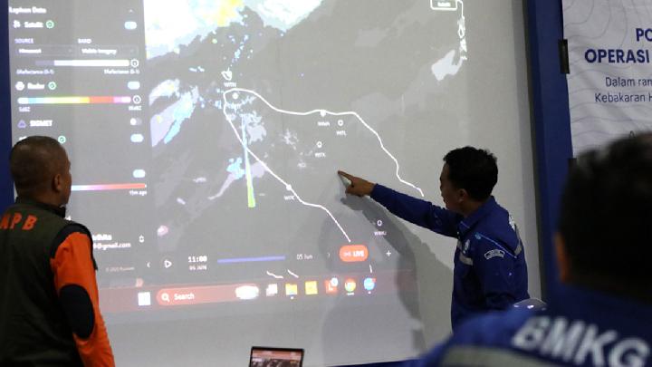
Ardhasena Sopaheluwakan, BMKG’s acting deputy for geophysics, explained that the agency’s network of twenty dedicated tsunami gauges together with high-frequency (HF) radar installations at Carita and Tanjung Lesung on Banten’s southern coast all returned readings consistent with normal ocean behaviour. The composite probability of a tsunami event, as calculated from those instruments, sat below the fifty-percent threshold that would ordinarily trigger a public advisory.
“Monitoring had detected no abnormal sea-level rise or significant changes in surface-current patterns that could indicate a tsunami,” Ardhasena stated.
Surface-wave measurements across the strait held steady in the range of half a metre to three metres, well within the band expected from prevailing winds and tidal cycles rather than from a seismic or volcanic impulse. Meteorological conditions were forecast to remain favourable as well, with sunny to partly cloudy skies anticipated through September 13, limiting any compounding effect from storm-driven swell.
The Eruption Itself: A Brief Strombolian Burst
The triggering event was modest in scale. The Volcanology and Geological Hazard Mitigation Center (PVMBG), which operates the seismic and visual surveillance stations around the island, logged a single Strombolian eruption at 7:49 a.m. local time on Tuesday. The seismic signal peaked at an amplitude of forty-eight millimetres and lasted nineteen seconds before decaying below detection threshold. Strombolian activity, characterised by rhythmic, low-to-moderate explosions ejecting incandescent clots of lava, is common at Anak Krakatau and generally poses limited hazard beyond the immediate vent area, though it can loft ash and gas high enough to affect aviation corridors and downwind communities.
Coordinated Weather-Modification Response
Even though no tsunami signal emerged, the agencies responsible for public safety treated the ash plume as an operational priority. BMKG, working alongside the National Disaster Management Agency (BNPB) and the Transportation Ministry, dispatched five dedicated weather-modification sorties on Tuesday. Two Cessna Caravan aircraft, based at Pondok Cabe and Halim Perdanakusuma airfields in the greater Jakarta area, carried out the missions.
The sorties employed a tiered chemical strategy. One flight dispersed sodium chloride powder into the plume to encourage droplet coalescence and accelerate ash fallout. A second sortie released calcium chloride in liquid form, acting as a cloud-condensation agent to promote precipitation of suspended particulate. The remaining three flights sprayed fine water mist directly into the ash column, increasing particle mass and hastening gravitational settling. Together, the operations aim to shorten the residence time of volcanic ash in the lower atmosphere over populated coastal zones.
Public Guidance and Health Considerations
Residents in districts downwind of the island were urged to curtail prolonged outdoor exposure while ash concentrations remained elevated. Ardhasena specifically recommended wearing fitted face masks and protective eyewear to minimise inhalation of fine silicate particles and ocular irritation. For communities along the strait’s narrow channels, where ash can accumulate in harbours and fishing settlements, the advice aligns with standard Indonesian volcanic-hazard protocols that emphasise respiratory protection over evacuation unless a higher alert level is declared.
The absence of a tsunami signature does not, however, close the monitoring window. BMKG and PVMBG maintain round-the-clock seismic, tilt, and gas-emission observation at Anak Krakatau, and the agency’s tsunami gauge network continues to sample sea level at high frequency. Should a future episode produce a sustained sea-level step exceeding background variability, the probability calculation would cross the advisory threshold and trigger the national early-warning cascade within minutes. For now, the strait’s waters remain calm, and the island’s latest outburst has been contained to a brief, low-energy episode.
Related Reading
Frequently Asked Questions
What is BMKG?
BMKG is the main topic of this guide. The article explains the context, practical details, and next steps readers should understand.
Why does BMKG matter?
BMKG matters because readers are looking for a useful answer, not just a short summary. Good content should match search intent and help them decide what to do next.